
Situated centrally in South Africa’s interior highveld plateau, the Free State province (covering an area of about 130,000 Sqkm) is bounded on the east by the high mountains of the Drakensberg and the Maluti of Lesotho. From the highest mountain peaks, at just over 2100m, the topography drops away to the west, through highly dissected hills and valleys followed by the gently undulating grassy plains of the central areas. The low-lying south-western regions at around 920m are also the driest.
Although a large part of the province is rural, the majority of the population is concentrated around the major urban centres of Bloemfontein (the provincial capital)/Thaba Nchu, Welkom, Kroonstad, Sasolburg and Harrismith. Agriculture is an important source of revenue and comprises mainly crops, (maize, wheat & sunflowers) livestock- (cattle & sheep) and game farming in areas unsuitable for crops. The Goldfields area in the north-west of the province, centred on Welkom, is one of the most important gold mining regions in South Africa. Extensive stretches of permanent water resulting from mining activities in this area produce ideal habitat for considerable diversity and numbers of waterbirds, especially Greater & Lesser Flamingos.
Much of the Free State has generally flat to slightly rolling topography, broken only by drainage lines and the occasional flat-topped hills or mesas. Characteristic of the western & north-western Free are natural pan systems, comprising shallow hollows with internal drainage from all sides; these represent important ephemeral sources of salty to fresh water during and after the rainy season in otherwise largely waterless, semi-arid areas.
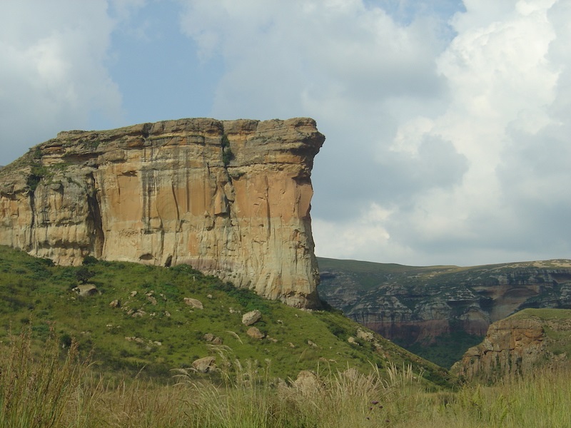
The highest-lying areas are formed by so-called cave sandstones of aeolian (wind-blown in a desert-type environment) origin, and the Drakensberg basalts. Cave sandstone typically forms near-vertical cliffs, often with an eroded lower portion sometimes producing spectacular overhangs, a number of which may be seen in Golden Gate Highlands National Park. The presence of many examples of rock art indicates the use of these overhangs as shelters by early people. Many flat-topped hills, showing sandstone cliffs capped with darker, volcanic basalt can be seen in the north-eastern parts of the Free State (e.g. Platberg, which overlooks Harrismith and Kerkenberg, towering over the nearby Sterkfontein Dam).
Apart from the Vaal River which flows southwards along the western boundary of the province, all of the major rivers rise in the higher-lying eastern parts of the Free State (or in neighbouring Lesotho) and flow north, west or south-west, with the densest drainage systems present in the moist north-east. Rivers generally flow during the summer rainy season only, but most retain at least some water throughout the year, providing water for birds in otherwise dry areas. A number of large man-made reservoirs also supplement the meagre natural water supply in a number of areas; state-owned and managed conservation areas usually surround them. Moist vlei/marsh areas found in the north-east of the Free State, especially in the Vrede-Memel-Harrismith districts, support a great diversity of bird species. Much of the western parts of the province have no natural water sources during the dry season, and birds in these areas rely heavily on water provided through farming activities.
Most rivers and their tributaries support dense riparian bush and thickets, representing important corridors of woody vegetation in otherwise open, grassland habitats. A number of interesting range extensions of certain bird species (e.g. Crested Barbet, Steel-blue Widowfinch & Red-billed Firefinch) into the more open, grassy interior of the Free State are believed largely to be attributed to these corridors.
The Free State experiences a summer rainfall, peaking in January in the north-east (averaging around 800mm per year) and March in the south-west (average under 400mm per year). Annual temperatures range from a maximum of about 35°C in mid-summer to a minimum of -5°C in mid-winter, although mean temperatures are usually between 15-30°C in summer and 0-15°C in winter. Winters are also characterised by moderate to severe frost, particularly in the higher-lying areas, and snowfall may also occur.
About 80% of the Free State is covered by grassland or mixed karoo shrub/grassland; within this and in the remaining 20%, a diverse number of vegetation types and habitats exist. Closely associated with climatic conditions in the province, ranging from the dry west to the moister east, main vegetation types in the province have a north-south orientation. Four types are recognised:
– the semi-arid Kalahari Thornveld/Shrub Bushveld/Pan Turfveld of the west;
– the semi-arid False Upper Karoo and False Arid Karoo of the south-west;
– the broad band of grassveld in the central parts of the Free State, ranging from dry grassland in the western interior to more moist areas in the east (this area is largely devoid of natural woody vegetation, although extensive thickets of Acacia thornveld occur in places, providing habitat for a number of bird species not usually found in grassveld);
– the moist highland grasslands and Afro-alpine vegetation in the far east and north-east.
Exotic trees and shrubs in urban areas and around farmsteads also provide important habitats for species that would otherwise not occur in these historically open grassland areas.
The higher-lying, mountainous areas of the far east (Vrede-Memel-Harrismith-Van Reenen-Qwa Qwa-Golden Gate) with higher rainfall, vlei areas and forested valleys provide habitats for a number of bird species found nowhere else in the province (e.g. Olive Woodpecker, Rudd’s Lark, Buff-streaked Chat, Bush Blackcap, Chorister Robin, Barratt’s Warbler, Gurney’s Sugarbird, Lesser Double-collared Sunbird, Blue-billed Firefinch, & Drakensberg Siskin).
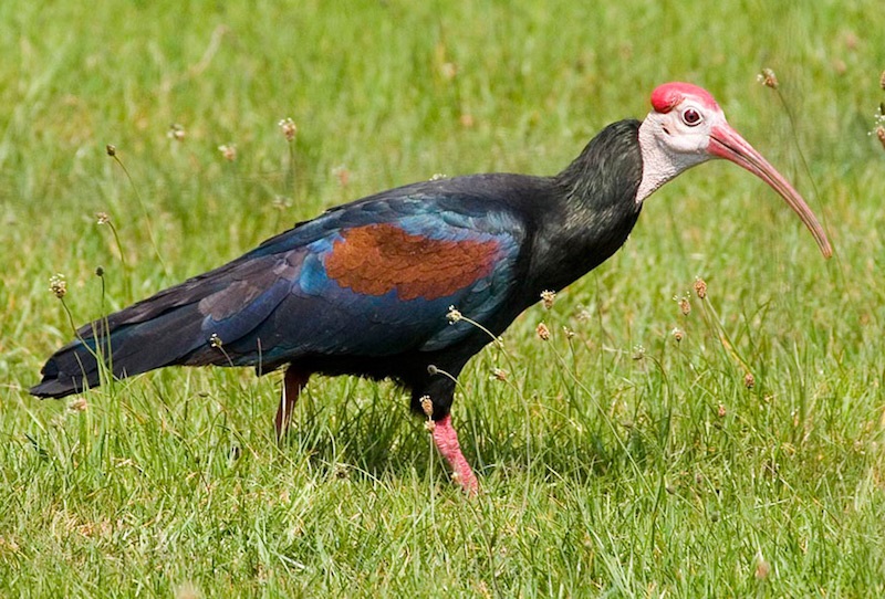
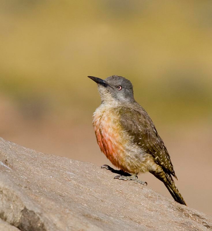
A total of about 430 bird species have been recorded in the Free State, including 105 southern African endemics and near-endemics. The province incorporates some of the most important areas in the southern Africa for certain endangered, restricted-range species such as Southern Bald Ibis, Rudd’s Lark, Botha’s Lark and Yellow-breasted Pipit.
Larger mammals, especially at Sandveld Nature Reserve and Willem Pretorius Game Reserve, include White Rhino, Buffalo, Giraffe, Eland, Roan and Sable Antelope, Gemsbok, Kudu, Red Hartebeest, Black and Blue Wildebeest, Burchell’s Zebra, Impala, Springbok, Grey Duiker, Steenbok and Black-backed Jackal. Aardwolf is occasionally seen and Yellow Mongoose, Slender Mongoose and Springhare are common.
Text Source: Fatbirder
Map Source: Googlemaps™
Photo Source: © Birding Ecotours