
Map
New Caledonia, is an overseas territory of France, made up of a main island (Grande Terre), the Loyalty Islands, and several smaller islands. It is located in the region of Melanesia in the southwest Pacific. At about half the size of Taiwan, it has a land area of 18,575.5 square kilometres (7,172 square miles). The population was 244,600 inhabitants as of January 2008 official estimates. The capital and largest city of the territory is Nouméa. The currency is the CFP franc.
New Caledonia is located in the southwest Pacific Ocean, approximately 1,200 kilometres (746 mi) east of Australia and 1,500 kilometres (932 mi) northwest of New Zealand. The island nation of Vanuatu lies to the northeast. It is made up of a main island and several smaller islands, the Belep archipelago to the north of the Grande Terre, the Loyalty Islands to the east of the Grande Terre, the Isle des Pins (Isle of Pines) to the south of the Grande Terre, the Chesterfield Islands and Bellona Reefs further to the west.
The Grande Terre is by far the largest of the islands, and the only mountainous one. It has an area of 16,372 square kilometres (6,321 square miles), and is elongated northwest to southeast, 350 kilometres (217 miles) in length and 50 to 70 kilometres (31 miles) wide. A mountain range runs the length of the island, with five peaks over 1,500 meters (4,900 feet). The total area of New Caledonia is 19,060 square kilometres (7,359 square miles), 18,575 square kilometres (7,172 square miles) of those being land.
New Caledonia is one of the northernmost parts of a (93%) submerged continent called Zealandia. It sank after drifting away from Australia 60 and 85 million years ago and from Antarctica between 130 and 85 million years ago.
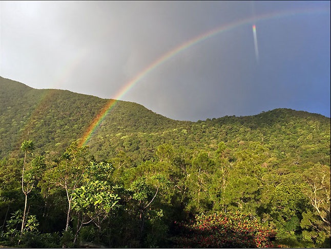
New Caledonia lies astride the Tropic of Capricorn. The climate of the islands is tropical, and rainfall is highly seasonal, brought by trade winds that usually come from the east. Rainfall averages about 1,500 millimetres (59 inches) yearly on the Loyalty Islands, 2,000 millimetres (79 inches) at low elevations on eastern Grande Terre, and 2,000-4,000 millimetres (79-157 inches) at high elevations on the Grande Terre. The western side of the Grande Terre lies in the rain shadow of the central mountains, and rainfall averages 1,200 millimetres (47 inches) per year.
There are two main seasons – a dry season, and a warm and wet season. The dry cooler months are from April to November with daily temperature ranges from 17-27C. During the wet season (December to March) the temperature can get as hot as 32C. The southeast trade winds temper the heat, and evenings are pleasantly cool. The wet season sees the occasional cyclone hitting the islands.
New Caledonia’s Ecology
New Caledonia is considered one of the world’s most botanically-important, and critically endangered hotspots. Unlike many of the Pacific Islands, which are of relatively recent volcanic origin, New Caledonia is an ancient fragment of the Gondwana super-continent. New Caledonia and New Zealand separated from Australia c.85 million years ago, and from one another 30 million years later. This isolated New Caledonia from the rest of the world’s landmasses, and made it a Noah’s Ark of sorts, preserving a snapshot of prehistoric Gondwanan forests. The country still shelters an extraordinary diversity of unique, endemic, and extremely primitive plants and animals of Gondwanan origin.
In the past, New Caledonia’s wildlife was even more ancient, almost resembling throwbacks to the Mesozoic. Meiolania, a gigantic turtle resembling a dinosaur ankylosaur, which was the size of a car, inhabited New Caledonia. Another inhabitant of New Caledonia was Sylviornis, a huge bird with a long, reptilian tail that resembled a dinosaur, probably most closely resembling the oviraptors. The dominant predators of New Caledonia were mekosuchine crocodiles, that resembled armoured, quadrupedal theropod dinosaurs, and fossil remains suggest they were terrestrial and partly arboreal. All of these creatures died out when humans arrived on New Caledonia.
Although the majority of the country’s citizens are unaware of the extraordinary nature of their country’s biological heritage, a few of the country’s animals and plants have become somewhat emblematic in local culture. Among the best known is a hen-sized, flightless bird, commonly known as the Cagou or Kagu, which has a large crest and an odd barking call. It is not only a species unique to the islands but is also the one and only representative of its avian family. Its song and image are frequently seen as nationally recognized icons.
There are at least fourtine endemic bird species too, icluding Barred Honeyeater, Kagu and New caledonian Lorikeet as well as endemic subspecies and at least nine very restricted-range species.
Another commonly used cultural emblem is the Columnar or Cook’s Pine Araucaria columnaris, an important symbol in Kanak culture. The Niaouli tree (also native to Australia and New Guinea) is of medicinal interest, locally and abroad. Its sap (which contains gomenol, a camphor-smelling compound), is used to treat head colds, and as an antiseptic. It also shows potential to treat other medical ailments.
Before the Europeans arrived, there was no mammal other than the Roussette (aka flying fox), a large vegetarian bat, considered a local delicacy. Less well-known by the native population is the fact their country is home to a species of plant, Amborella trichopoda believed to be genetically close to the ancestor of all flowering plants, or the fact their nation boasts the largest number and diversity of conifer species in the world, per unit of geographic area (a remarkable fact, given that conifers are usually relatively rare in tropical regions).
The islands contain two precipitation zones: Higher-rainfall areas (located on the Loyalty Islands, Isle of Pines and on the eastern side of Grande Terre), which support New Caledonia rain forests, and a more arid region, home to the now exceedingly-endangered New Caledonia dry forests, located in the rain shadow on the western side of Grande Terre. Europeans settled on the dry west coast of Grande Terre, leaving the east (as well as the Loyalty Islands and the Isle of Pines) to the Kanaks, and resulting in an ethno-cultural division, which coincides with the natural one. Extensive farming by Europeans in the dry forest areas, has caused these forest ecosystems to virtually disappear.
It is a vast over simplification, however, to merely describe New Caledonia’s extremely important, complex and diverse ecology in terms of precipitation zones. Species and ecological diversity is further complicated by soil type (degree and type of mineralization), altitude, and geographic location (for instance, Loyalty Islands and Isle of Pines have flora that is distinct from Grande Terre).
In addition to the remarkable terrestrial environment of New Caledonia, the country is also home to important aquatic ecosystems. Its freshwater ecology also evolved in long isolation, and the New Caledonia rivers and streams are home to many endemic species. Moreover, the New Caledonia Barrier Reef, which surrounds Grande Terre and the Isle of Pines is the second-largest coral reef in the world after Australia’s Great Barrier Reef, reaching a length of 1,500 kilometres (930 miies). Like its terrestrial counterpart, the Caledonian reef system has great species diversity, is home to endangered dugongs Dugong dugong, and is an important nesting site for the Green Sea Turtle Chelonia mydas. The Nautilus is a living-fossil species, once common during the age of the dinosaurs, and survives today in the waters surrounding New Caledonia. The reefs are a UNESCO World Heritage Site.
There are a number of reserves and areas of special interest, the most notable being:
Le Parc Provincial des Grandes Fougeres (map HERE), which is at the crossroads of Farino, Moindou and Sarramea. The Giant Fern Park is a welcoming and people-friendly environment, perfect for walking or riding mountain bikes. You can create your own itineraries from the many walking trails in the 4,500 hectare tropical rain forest, which is set in an altitude of between 400m and 700m.
And:
Riviere Bleue Provincial Park (map HERE), the Blue River Provincial Park was created in 1980 and stretches over 9,045 hectares. Lumber and mining operations at the turn of the century have left marks that are still visible.
Main Source: Fatbirder
Photos Source:
Map source: Googlemaps™